Florida Memory is administered by the Florida Department of State, Division of Library and Information Services, Bureau of Archives and Records Management. The digitized records on Florida Memory come from the collections of the State Archives of Florida and the special collections of the State Library of Florida.

State Archives of Florida
- ArchivesFlorida.com
- State Archives Online Catalog
- ArchivesFlorida.com
- ArchivesFlorida.com
State Library of Florida
Related Sites
Description of previous item
Description of next item

Source
Description
Date
Format
Coverage
Personal Subjects
Subjects
Geographic Term
Note to Researchers:
Though the WPA field workers included extensive citations for the factual information contained in these county histories, it should be noted that these historical narratives were produced in the 1930s by federal government employees, and might reflect the inherent social biases of the era.
13
Historical Sketch
(First entry, p. 156)
2; Protestant Episcopal, 2; and Roman Catholic, 2. At Penny Farms there is an inter-denominational community chapel.(66)
Transportation facilities have been important factors in determining the development of Clay county. The Middleburg-Webster community undoubtably owed its early development in large part to the navigability of Black Creek and to the fact that it lay on the main road from Jacksonville to the Alachua settlements.(67) The first railroad to enter the county was the Florida Railroad, completed from Fernandina to Cedar Keys just before the outbreak of the War Between the States. This road contributed little to Clay county, however, as less than 6 miles of its track cross the extreme northwest corner of the county.(68) Easy water transportation was afforded by the St. Johns River, with the result that the eastern part of the county first developed after the war.
The railroad development of the early eighties did much to attract settlers to the county. The Green Cove Springs and Melrose Railroad Company was incorporated in 1881 to build a line across Clay county from Sharon then being its western terminus.(70) The road had been extended to Belmore by 1892,(71) and apparently was pushed westward after that year. It had ceased to operate, however, by 1901.(72) Of more lasting importance to Clay county was the building of the Jacksonville and Palatka Railroad, also incorporated in 1881.(73) By 1884 this railroad, its name changed to the Jacksonville, Tampa and Key West, ran the full length of the eastern border of the county.(74) By 1895 the present line of the _____________________________________________________________ 66. Work Projects Administration, Florida Historical Records Survey, A Preliminary List of Religious Bodies in Florida, pp. 29-32.
67. See Apalachicola Gazette, Sept. 12, 1840; St. Augustine Florida Herald, Aug. 15, 1842.
68. Florida Comptroller, Report, 1895, p. 24. This railroad, which was operating in 1895 as the Florida Central and Peninsula Railroad, is now part of the Seaboard Air Line system.
69. Acts, 1881, ch. 3330.
70. John R. Richards, Florida State Gazeteer, p. 174.
71. Charles Ledyard Norton, A Handbook of Florida, p. 16.
72. The company was listed by the Comptroller in 1895 as the Southwestern Railroad, formerly the Green Cove Springs and Melrose and the Western Railroad of Florida, with 33.5 miles of track (Florida Comptroller, Report, 1895, p. 14). It was not listed by the Comptroller in 1901, nor does the railroad appear on current maps.
73. A. A. Robinson, Florida, A Pamphlet Descriptive of Its History...and Natural Advantages, p. 70.
74. Roland H. Rerick, Memoirs of Florida, II, 88. Later known as the Jacksonville Division of the Savannah, Florida and Western (Florida Comptroller, Report, 1901, p. 43.), this road is now part of the Atlantic Coast Line system.
Title
Subject
Description
Creator
Source
Date
Format
Language
Type
Identifier
Coverage
Thumbnail
Geographic Term
ImageID
Subject - Person
Transcript
5
(First entry, p. 156)
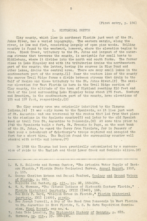
1. HISTORICAL SKETCH
Clay county, which lies in northeast Florida just west of the St. Johns River, has a varied topography. The eastern margin, along the river, is low and flat, consisting largely of open pine woods. Rolling country is found to the westward, however, where the elevation begins to rise. Black Creek, tributary to the St. Johns and largest of the numerous streams that traverse the county, is navigable for small boats to Middleburg, where it divides into the north and south forks. The former rises in Lake Kingsley and with its tributaries drains the northwestern part of the county; the latter, having its sources in Blue Pond and other lakes, drains the central area. There are many small lakes in the southwestern part of the county.(1) Near the western line of the county the narrow Trail Ridge forms a divide between streams that drain to the Gulf of Mexico and those tributary to the St. Johns River.(2) The maximum elevation for East Florida is here in the Trail Ridge section of Clay county, the altitude of the town of Highland reaching 210 feet and that of the land surrounding Lake Kingsley being about 175 feet. Newburg and Brooklyn, in the southwestern part of the county, have elevations of 155 and 157 feet, respectively.(3)
The Clay county area was originally inhabited by the Timucua Indians.(4) It was early known to the Spaniards, as it lies just west of St. Augustine and was traversed by the routes that led from that place to the missions in the Apalache country(5) and later by the old Spanish road or trail from St. Augustine to Pensacola.(6) At some time prior to 1740 the Spaniards built a fort, St. Francis de Pupa, on the west bank of the St. Johns, to guard the ferry from Picolata, for in January of that year a detachment of Oglethorpe's troops captured and occupied the fort for a short time. The English found the surrounding country well stocked with cattle and horses.(7)
By 1728 the Timucua had been practically exterminated by a succession of raids by the English and their Lower Creek and Seminole allies.(8) _____________________________________________________________ 1. E.H. Sellards and Herman Gunter, “The Artesian Water Supply of Eastern Florida,” Florida State Geological Survey, Annual Report, 1910, p. 153.
2. George Charlton Matson and Samuel Sanford, Geology and Ground Waters of Florida, p. 283.
3. Sellards and Gunter, op. cit., pp. 92, 153-154.
4. W.W. Ehrmann, “The Timucua Indians of Sixteenth Century Florida,” Florida Historical Quarterly, XVIII (1940), 168.
5. See Mark F. Boyd, “Mission Sites in Florida,” Florida Historical Quarterly, XVII (1939), passim.
6. See Joseph Purcell, A Map of the Road from Pensacola in West Florida to St. Augustine in East Florida, U. S. De Soto Expedition Commission, Final Report, map no. 4.
7. John Tate Lanning, The Diplomatic History of Georgia, p. 223.
8. Ehrmann, op. cit., pp. 189-190.
6
(First entry, p. 156)
Historical Sketch
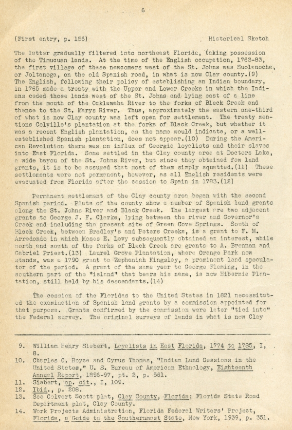
The latter gradually filtered into northeast Florida, taking possession of the Timucuan lands. At the time of the English occupation, 1763-83, the first village of these newcomers west of the St. Johns was Suolanoche, or Joltanoga, on the old Spanish road, in what is now Clay county.(9) The English, following their policy of establishing an Indian boundary, in 1765 made a treaty with the Upper and Lower Creeks in which the Indians ceded those lands west of the St. Johns and lying east of a line from the mouth of the Ocklawaha River to the forks of Black Creek and thence to the St. Marys River. Thus, approximately the eastern one-third of what is now Clay county was left open for settlement. The treaty mentions Colville's plantation at the forks of Black Creek, but whether it was a recent English plantation, as the name would indicate, or a well-established Spanish plantation, does not appear.(10) During the American Revolution there was an influx of Georgia loyalists and their slaves into East Florida. Some settled in the Clay county area at Doctors Lake, a wide bayou of the St. Johns River, but since they obtained few land grants, it is to be assumed that most of them simply squatted.(11) These settlements were not permanent, however, as all English residents were evacuated from Florida after the cession to Spain in 1783.(12)
Permanent settlement of the Clay county area began with the second Spanish period. Plats of the county show a number of Spanish land grants along the St. Johns River and Black Creek. The largest are two adjacent grants to George J. F. Clarke, lying between the river and Governor's Creek and including the present site of Green Cove Springs. South of Black Creek, between Bradley's and Peters Creeks, is a grant to F. M. Arredondo in which Moses E. Levy subsequently obtained an interest, while north and south of the forks of Black Creek are grants to A. Brennan and Gabriel Priest.(13) Laurel Grove Plantation, where Orange Park now stands, was a 1790 grant to Zephaniah Kingsley, a prominent land speculator of the period. A grant of the same year to George Fleming, in the southern part of the “island” that bears his name, is now Hibernia Plantation, still held by his descendants.(14)
The cession of the Floridas to the United States in 1821 necessitated the examination of Spanish land grants by a commission appointed for that purpose. Grants confirmed by the commission were later “tied into” the Federal survey. The original surveys of lands in what is now Clay _____________________________________________________________ 9. William Henry Siebert, Loyalists in East Florida, 1774 to 1785, I, 8.
10. Charles C. Royce and Cyrus Thomas, “Indian Land Cessions in the United States,” U. S. Bureau of American Ethnology, Eighteenth Annual Report, 1896-97, pt. 2, p. 561.
11. Siebert, op. cit., I, 109.
12. Ibid., p. 208.
13. See Colvert Scott plat, Clay County, Florida; Florida State Road Department plat, Clay County.
14. Work Projects Administration, Florida Federal Writers' Project, Florida, a Guide to the Southernmost State, New York, 1939, p. 351.
7
Historical Sketch
(First entry, p. 156)
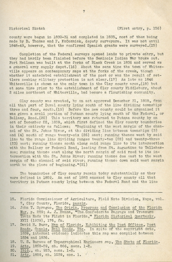
county were begun in 1830-31 and completed in 1835, most of them being made by D. Thomas and P. McCormick, deputy surveyors. It was not until 1848-49, however, that the confirmed Spanish grants were surveyed.(15)
Completion of the Federal surveys opened lands to private entry, but they had hardly been finished before the Seminole Indian War broke out. Fort Heilman was built at the forks of Black Creek in 1836 and served as a general army supply depot.(16) About the same time the town of Whitesville appears on contemporary maps at the forks of the creek, though whether it antedated establishment of the post or was the result of settlers seeking military protection is not clear.(17) As late as 1846 Whitesville is shown as the only town in the Clay county area,(18) but at some time prior to the establishment of Clay county Middleburg, about 2 miles northeast of Whitesville, had become a flourishing community.
Clay county was created, by an act approved December 31, 1858, from all that part of Duval county lying south of the line dividing townships three and four, south.(19) Before the new county could be organized it was given a small portion of Putnam county lying south of the Federal, or Bellamy, Road.(20) This territory was returned to Putnam county by an act of December 22, 1859, which first defined the Clay county boundaries in their entirety as follows: “Beginning at the west margin of the channel of the St. Johns River, at the dividing line between townships (3) and (4) south of range twenty-six (26) east; running thence west by said line to the range line dividing ranges twenty-two (22) and twenty-three (23) east; running thence south along said range line to its intersection with the Bellamy or Federal Road, leading from St. Augustine to Tallahassee; running thence east along the north margin of said road to its intersection with the St. Johns River; running thence due east to the west margin of the channel of said river; running thence down said west margin north to the place of beginning.”(21)
The boundaries of Clay county remain today substantially as they were defined in 1859. An act of 1883 annexed to Clay county all that territory in Putnam county lying between the Federal Road and the line _____________________________________________________________ 15. Florida Commissioner of Agriculture, Field Note Division, Maps, vol. 7, Clay County, Florida, passim.
16. John T. Sprague, The Origin, Progress and Conclusion of the Florida War, p. 229; A. J. Hanna, “The Confederate Baggage and Treasure Train Ends its Flight in Florida," Florida Historical Quarterly, XVII (1939), 176, fn.
17. David H. Burr, Map of Florida, Exhibiting the Post Offices, Post Roads, Canals, Rail Roads, Etc. In spite of the copyright date, 1839, internal evidence indicates this map was compiled between 1834 and 1836.
18. U. S. Bureau of Topographical Engineers map, The State of Florida.
19. Acts, 1858-59, ch. 866, secs. 1-2.
20. Ibid., ch. 923, secs. 1-2.
21. Acts, 1859, ch. 1039, sec. 1.
8
(First entry, p. 156)
Historical Sketch
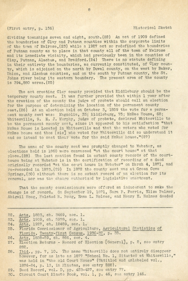
dividing townships seven and eight, south.(22) An act of 1909 defined the boundaries of Clay and Putnam counties within the corporate limits of the town of Melrose,(23) while a 1927 act so redefined the boundaries of Putnam county as to place in that county all of the town of Melrose and its immediate vicinity, which had previously been in the counties of Clay, Putnam, Alachua, and Bradford.(24) There is no statue defining in their entirety the boundaries, as currently constituted, of Clay county, which is adjoined on the north by Duval county, on the west by Baker, Union, and Alachua counties, and on the south by Putnam county, the St. Johns river being its eastern boundary. The present area of the county is 394,880 acres.(25)
The act creating Clay county provided that Middleburg should be the temporary county seat. It was further provided that within 1 year after the creation of the county the judge of probate should call an election for the purpose of determining the location of the permanent county seat.(26) At an election held on October 3, 1859 the vote for a permanent county seat was: Magnolia, 33; Middleburg, 75; McRae House, 68; Whitesville, 9. M. J. Murphy, judge of probate, declared Whitesville to be the permanent county seat, since it appeared to his satisfaction “that McRae is Located in Whiteville and that the voters who voted for McRae House and thos [sic] who voted for Whitesville did so understand it and so intend to cast their vote for the said McRae house.”(27)
The name of the county seat was promptly changed to Webster, as elections held in 1860 were canvassed “at the court house” at that place.(28) The last mention found in extant county records of the courthouse being at Webster is in the certification of recording of a deed originally recorded “at the court house in Webster” on March 4, 1871, and re-recorded in 1873.(29) In 1872 the county seat was at Green Cove Springs,(30) although there is no extant record of an election for its removal, nor was the change authorized by legislative enactment.
That the county commissioners were offered an inducement to make the change is of record. On September 19, 1871, Sara P. Ferris, Eliza Palmer, Abigail Hoeg, Halsted H. Hoeg, Emma L. Holmes, and Henry E. Holmes deeded ____________________________________________________________ 22. Acts, 1883, ch. 3469, sec. 1.
23. Acts, 1909, ch. 5978, sec. 1.
24. Acts, 1927, ch. 12489, sec. 1.
25. Florida Commissioner of Agriculture, Agricultural Statistics of Florida, Twenty-first Census, 1936-37, p. 35.
26. Acts, 1858-59, ch. 866, sec. 4.
27. Election Returns - Record of Election [General], p. 2, see entry 282.
28. Ibid., pp. 7, 10. The name Whitesville does not entirely disappear however, for as late as 1877 “School No. 1, Situated at Whitesville,” was held at in “the old Court House" (Untitled and unlabeled vol., 1876-84, p. 13, in Minutes, see entry 288).
29. Deed Record, vol. D, pp. 423-427, see entry 77.
30. Circuit Court Minute Book, vol. 1, p. 46, see entry 146.
9
Historical Sketch
(First entry, p. 156)
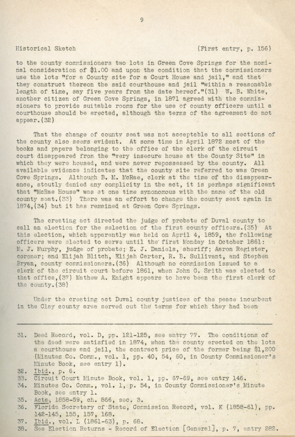
to the county commissioners two lots in Green Cove Springs for the nominal consideration of $1.00 and upon the condition that the commissioners use the lots “for a County site for a Court House and jail,” and that they construct thereon the said courthouse and jail “within a reasonable length of time, say five years from the date hereof.”(31) W. B. White, another citizen of Green Cove Springs, in 1871 agreed with the commissioners to provide suitable rooms for the use of county officers until a courthouse should be erected, although the terms of the agreement do not appear.(32)
That the change of county seat was not acceptable to all sections of the county also seems evident. At some time in April 1872 most of the books and papers belonging to the office of the clerk of the circuit court disappeared from the “very insecure house at the County Site” in which they were housed, and were never repossessed by the county. All available evidence indicates that the county site referred to was Green Cove Springs. Although B. M. McRae, clerk at the time of the disappearance, stoutly denied any complicity in the act, it is perhaps significant that “McRae House” was at one time synonymous with the name of the old county seat.(33) There was an effort to change the county seat again in 1874,(34) but it has remained at Green Cove Springs.
The creating act directed the judge of probate of Duval county to call an election for the selection of the first county officers.(35) At this election, which apparently was held on April 4, 1859, the following officers were elected to serve until the first Monday in October 1861: M. J. Murphy, judge of probate; E. J. Daniels, sheriff; Aaron Register, coroner; and Elijah Blitch, Elijah Carter, R. B. Sullivant, and Stephen Bryan, county commissioners.(36) Although no commission issued to a clerk of the circuit court before 1861, when John G. Smith was elected to that office,(37) Mathew A. Knight appears to have been the first clerk of the county.(38)
Under the creating act Duval county justices of the peace incumbent in the Clay county area served out the terms for which they had been _____________________________________________________________ 31. Deed Record, vol. D, pp. 121-125, see entry 77. The conditions of the deed were satisfied in 1874, when the county erected on the lots a courthouse and jail, the contract price of the former being $1,200 (Minutes Co. Comm., vol. 1, pp. 40, 54, 60, in County Commissioner’s Minute Book, see entry 1).
32. Ibid., p. 6.
33. Circuit Court Minute Book, vol. 1, pp. 67-69, see entry 146.
34. Minutes Co. Comm., vol. 1, p. 54, in County Commissioner’s Minute Book, see entry 1.
35. Acts, 1858-59, ch. 866, sec. 3.
36. Florida Secretary of State, Commission Record, vol. K (1858-61), pp. 142-145, 155, 157, 168.
37. Ibid., vol. L (1861-63), p. 68.
38. See Election Returns - Record of Election [General], p. 7, entry 282.
10
(First entry, p. 156)
Historical Sketch
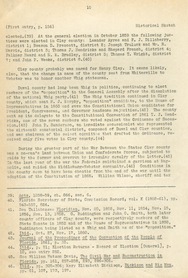
elected.(39) At the general election in October 1859 the following justices were elected in Clay county: Leander Ayres and F. J. Dillaberry, district 1; Reason D. Prescott, district 2; Joseph Truluck and Wm. R. Harris, district 3; Thomas J. Hendricks and Shepard French, district 4; Falkner Heard and N. M. Bradley, district 5; Thomas T. Wright, district 7; and John P. Weeks, district 8.(40)
Clay county probably was named for Henry Clay. It seems likely, also, that the change in name of the county seat from Whitesville to Webster was to honor another Whig statesman.
Duval county had long been Whig in politics, continuing to elect members of the “opposition” to the General Assembly after the dissolution of the national Whig party.(41) The Whig tradition continued in Clay county, which sent M. J. Murphy, “opposition” candidate, to the House of Representatives in 1860 and gave the Constitutional Union candidates for President, Congressman, and Governor handsome majorities.(42) The county sent as its delegate to the Constitutional Convention of 1861 T. J. Hendricks, one of the seven members who voted against the Ordinance of Secession.(43) John P. Sanderson, an immediate secessionist who represented the sixteenth senatorial district, composed of Duval and Clay counties, and was chairman of the select committee that drafted the Ordinance, received only five votes in Clay county.(44)
During the greater part of the War Between the States Clay county was a no-man's land between Union and Confederate forces, subjected to raids by the former and overrun by irregular calvary of the latter. (45) In the last year of the war the Federals maintained a garrison at Magnolia, and raided the Middleburg-Webster community. (46) Conditions in the county seem to have been chaotic from the end of the war until the adoption of the Constitution of 1868. William Wilson, sheriff and tax
_____________________________________________________________ 39. Acts, 1858-59, ch. 866, sec. 6.
40. Florida Secretary of State, Commission Record, vol. K (1858-61), pp. 543-552, 824.
41. See Tallahassee Floridian, Nov. 20, 1852, Nov. 11, 1854, Nov. 15, 1856, Nov. 13, 1858. O. Buddington and John G. Smith, both later county officers of Clay county, were respectively members of the State Senate in 1852 and of the House of Representatives in 1858, Buddington being listed as a Whig and Smith as of the “opposition.”
42. Ibid., Oct. 27, Nov. 17, 1860.
43. Journal of the Proceedings of the Convention of the People of Florida, 1861, p. 35.
44. Ibid., p. 21; Election Returns - Record of Election [General], p. 10, see entry 282.
45. See William Watson Davis, The Civil War and Reconstruction in Florida, pp. 161, 257-258, 293, 296-306.
46. Ibid. pp. 305-306; Mary Elizabeth Dickinson, Dickinson and His Men, pp. 61, 107, 173, 197.
11
Historical Sketch
(First entry, p. 156)
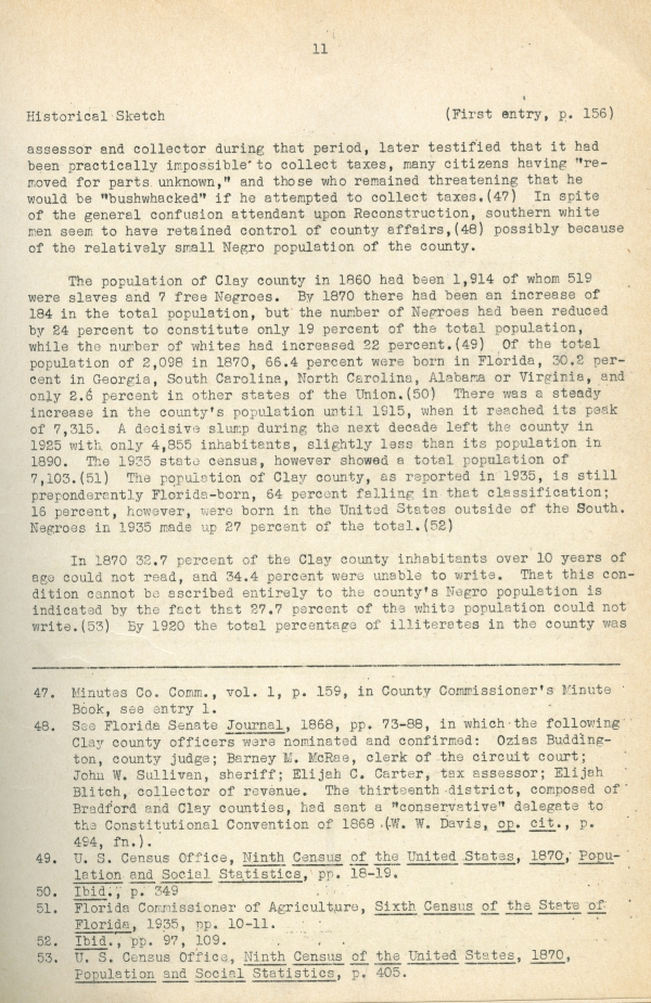
assessor and collector during that period, later testified that it had been practically impossible to collect taxes, many citizens having “removed for parts unknown,” and those who remained threatening that he would be “bushwhacked” if he attempted to collect taxes.(47) In spite of the general confusion attendant upon Reconstruction, southern white men seem to have retained control of county affairs,(48) possibly because of the relatively small Negro population of the county.
The population of Clay county in 1860 had been 1,914 of whom 519 were slaves and free Negroes. By 1870 there had been an increase of 184 in the total population, but the number of Negroes had been reduced by 24 percent to constitute only 19 percent of the total population, while the number of whites has increased 22 percent.(49) Of the total population of 2,098 in 1870, 66.4 percent were born in Florida, 30.2 percent in Georgia, South Carolina, North Carolina, Alabama, or Virginia, and only 2.6 percent in other states of the Union.(50) There was a steady increase in the county’s population until 1915, when it reached its peak of 7,315. A decisive slump during the next decade left the county in 1925 with only 4,855 inhabitants, slightly less than its population in 1890. The 1935 state census, however, showed a total population of 7,103.(51) The population of Clay county, as reported in 1935, is still preponderantly Florida-born, 64 percent falling in that classification; 16 percent, however, were born in the United States outside of the South. Negroes in 1935 made up 27 percent of the total.(52) In 1870 32.7 percent of the Clay county inhabitants over 10 years of age could not read, and 34.4 percent were unable to write. That this condition cannot be ascribed entirely to the county’s Negro population is indicated by the fact that 27.7 percent of the white population could not write.(53) By 1920 the total percentage of illiterates in the county was _____________________________________________________________ 47. Minutes Co. Comm., vol. 1, p. 159, in County Commissioner’s Minute Book, see entry 1. 48. See Florida Senate Journal, 1868, pp. 73-88, in which the following Clay county officers were nominated and confirmed: Ozias Buddington, county judge; Barney M. McRae, clerk of the circuit court; John W. Sullivan, sheriff; Elijah C. Carter, tax assessor; Elijah Blich, collector of revenue. The thirteenth district, composed of Bradford and Clay counties, had sent a “conservative” delegate to the Constitutional Convention of 1868 (W. W. Davis, op. cit., p.494, fn.). 49. U.S. Census Office, Ninth Census of the United States, 1870, Population and Social Statistics, pp. 18-19. 50. Ibid., p. 349 51. Florida Commissioner of Agriculture, Sixth Census of the State of Florida, 1935, pp. 10-11. 52. Ibid., pp. 97, 109. 53. U. S. Census Office, Ninth Census of the United States, 1870, Population and Social Statistics, p. 405.
12
(First entry, p. 156)
Historical Sketch
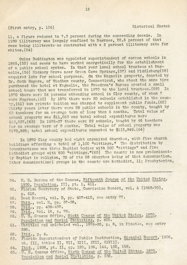
11, a figure reduced to 7.3 percent during the succeeding decade. In 1930 illiteracy was largely confined to Negroes, 22.6 percent of that race being illiterate as contrasted with a 2 percent illiteracy rate for whites.(54)
Ozias Buddington was appointed superintendent of common schools in 1869,(55) and seems to have worked energetically for the establishment of a public school system. In that year local school trustees at Magnolia,(56) Hickory Grove near Green Cove Springs,(57) and Middleburg(58) acquired lots for school purposes. On the Magnolia property, donated by Dr. Seth Rogers, of Windham county, Connecticut, who about the same time purchased the hotel at Magnolia, the Freedmen’s Bureau erected a small school house that was transferred in 1870 to the local trustees.(59) In 1870 there were 54 persons attending school in Clay county, of whom 7 were Negroes.(60) By 1876 there were 20 schools established in the county,(61) but private tuition was charged to supplement public funds.(62) Thirty years later there were 28 public schools in the county, taught by 43 teachers for an average term of less than 6 months. Total value of school property was $11,863 and total school expenditures were $13,537.(63) In 1936-37 there were 29 schools, taught by 46 teachers for an average term of 8 months. Total value of school property was $170,895; total school expenditures amounted to $112,849.(64)
In 1870 Clay county had eight organized churches, with five church buildings affording a total of 1,100 “sittings.” The distribution by denominations was three Baptist bodies with 500 “sittings” and five Methodist groups with 600 “sittings.”(65) The county is now predominantly Baptist in religion, 35 of its 68 churches being of that denomination. Other denominational groups in the county are Methodist, 11; Presbyterian, _____________________________________________________________ 54. U. S. Bureau of the Census, Fifteenth Census of the United States, 1930, Population, III, pt. 1, 411.
55. Florida Secretary of State, Commission Record, vol. A (1868-70), p. 618.
56. Deed Record, vol. D, pp. 407-410, see entry 77.
57. Ibid., vol. H, pp. 37-38.
58. Ibid., pp. 436-437.
59. Ibid., vol. 16, p. 78.
60. U. S. Census Office, Ninth Census of the United States, 1870, Population and Social Statistics, p. 405.
61. Untitled and unlabeled vol., 1876-85, p. 8, in Minutes, see entry 288.
62. Ibid., p. 4.
63. Florida Superintendent of Public Instruction, Biennial Report, 1906, ch. III, tables II, VII, XIII, XVII, XXVIII.
64. Ibid., 1938, pt. II, pp. 120, 136, 144, 152, 168.
65. U. S. Census Office, Ninth Census of the United States, 1870, Population and Social Statistics, p. 532.
13
Historical Sketch
(First entry, p. 156)
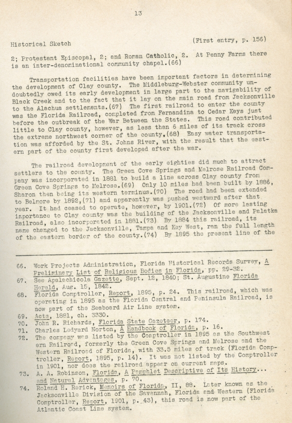
2; Protestant Episcopal, 2; and Roman Catholic, 2. At Penny Farms there is an inter-denominational community chapel.(66)
Transportation facilities have been important factors in determining the development of Clay county. The Middleburg-Webster community undoubtably owed its early development in large part to the navigability of Black Creek and to the fact that it lay on the main road from Jacksonville to the Alachua settlements.(67) The first railroad to enter the county was the Florida Railroad, completed from Fernandina to Cedar Keys just before the outbreak of the War Between the States. This road contributed little to Clay county, however, as less than 6 miles of its track cross the extreme northwest corner of the county.(68) Easy water transportation was afforded by the St. Johns River, with the result that the eastern part of the county first developed after the war.
The railroad development of the early eighties did much to attract settlers to the county. The Green Cove Springs and Melrose Railroad Company was incorporated in 1881 to build a line across Clay county from Sharon then being its western terminus.(70) The road had been extended to Belmore by 1892,(71) and apparently was pushed westward after that year. It had ceased to operate, however, by 1901.(72) Of more lasting importance to Clay county was the building of the Jacksonville and Palatka Railroad, also incorporated in 1881.(73) By 1884 this railroad, its name changed to the Jacksonville, Tampa and Key West, ran the full length of the eastern border of the county.(74) By 1895 the present line of the _____________________________________________________________ 66. Work Projects Administration, Florida Historical Records Survey, A Preliminary List of Religious Bodies in Florida, pp. 29-32.
67. See Apalachicola Gazette, Sept. 12, 1840; St. Augustine Florida Herald, Aug. 15, 1842.
68. Florida Comptroller, Report, 1895, p. 24. This railroad, which was operating in 1895 as the Florida Central and Peninsula Railroad, is now part of the Seaboard Air Line system.
69. Acts, 1881, ch. 3330.
70. John R. Richards, Florida State Gazeteer, p. 174.
71. Charles Ledyard Norton, A Handbook of Florida, p. 16.
72. The company was listed by the Comptroller in 1895 as the Southwestern Railroad, formerly the Green Cove Springs and Melrose and the Western Railroad of Florida, with 33.5 miles of track (Florida Comptroller, Report, 1895, p. 14). It was not listed by the Comptroller in 1901, nor does the railroad appear on current maps.
73. A. A. Robinson, Florida, A Pamphlet Descriptive of Its History...and Natural Advantages, p. 70.
74. Roland H. Rerick, Memoirs of Florida, II, 88. Later known as the Jacksonville Division of the Savannah, Florida and Western (Florida Comptroller, Report, 1901, p. 43.), this road is now part of the Atlantic Coast Line system.
14
(First entry, p. 156)
Historical Sketch
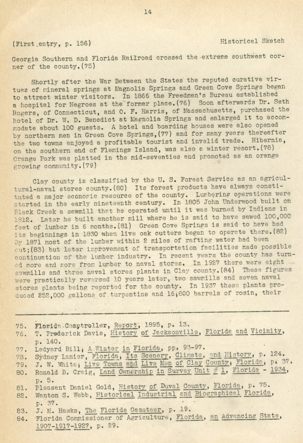
Georgia Southern and Florida Railroad crossed the extreme southwest corner of the county.(75)
Shortly after the War Between the States the reputed curative virtues of mineral springs at Magnolia Springs and Green Cove Springs began to attract winter visitors. In 1866 the Freedmen’s Bureau established a hospital for Negroes at the former place.(76) Soon afterwards Dr. Seth Rogers, of Connecticut, and O. F. Harris, of Massachusetts, purchased the hotel of Dr. W. D. Benedict at Magnolia Springs and enlarged it to accommodate about 100 guests. A hotel and boarding houses were also opened by northern men in Green Cove Springs,(77) and for many years thereafter the two towns enjoyed a profitable tourist and invalid trade. Hibernia, on the southern end of Flemings Island, was also a winter resort.(78) Orange Park was platted in the mid-seventies and promoted as an orange growing community.(79)
Clay county is classified by the U. S. Forest Service as an agricultural-naval stores county.(80) Its forest products have always constituted a major economic resource of the county. Lumbering operations were stated in the early ninetieth century. In 1805 John Underwood build on Black Creek a sawmill that he operated until it was burned by Indians in 1812. Later he built another mill where he is said to have sawed 100,000 feet of lumber in 6 months.(81) Green Cove Springs is said to have had its beginnings in 1830 when live oak cutters began to operate there.(82) By 1871 most of the lumber within 2 miles of rafting water had been cut;(83) but later improvement of transportation facilities made possible continuation of the lumber industry. In recent years the county has turned more and more from lumber to naval stores. In 1927 there were eight sawmills and three naval stores plants in Clay county.(84) These figures were practically reversed 10 years later, two sawmills and seven naval stores plants being reported for the county. In 1937 these plants produced 252,000 gallons of turpentine and 16,800 barrels of rosin, their _____________________________________________________________ 75. Florida Comptroller, Report, 1895, p. 13.
76. T. Frederick Davis, History of Jacksonville, Florida and Vicinity, p. 140.
77. Ledyard Bill, A Winter in Florida, pp. 93-97.
78. Sydney Lanier, Florida, Its Scenery, Climate, and History, p. 124.
79. J. W. White, Live Towns and Live Men of Clay County, Florida, p. 37.
80. Ronald B. Craig, Land Ownership in Survey Unit #1, Florida - 1934, p. 5.
81. Pleasant Daniel Gold, History of Duval County, Florida, p. 75.
82. Wanton S. Webb, Historical Industrial and Biographical Florida, p. 37.
83. J. M. Hawks, The Florida Gazeteer, p. 19.
84. Florida Commissioner of Agriculture, Florida, an Advancing State, 1907-1917-1927, p. 29.
15
Historical Sketch
(First entry, p. 156)
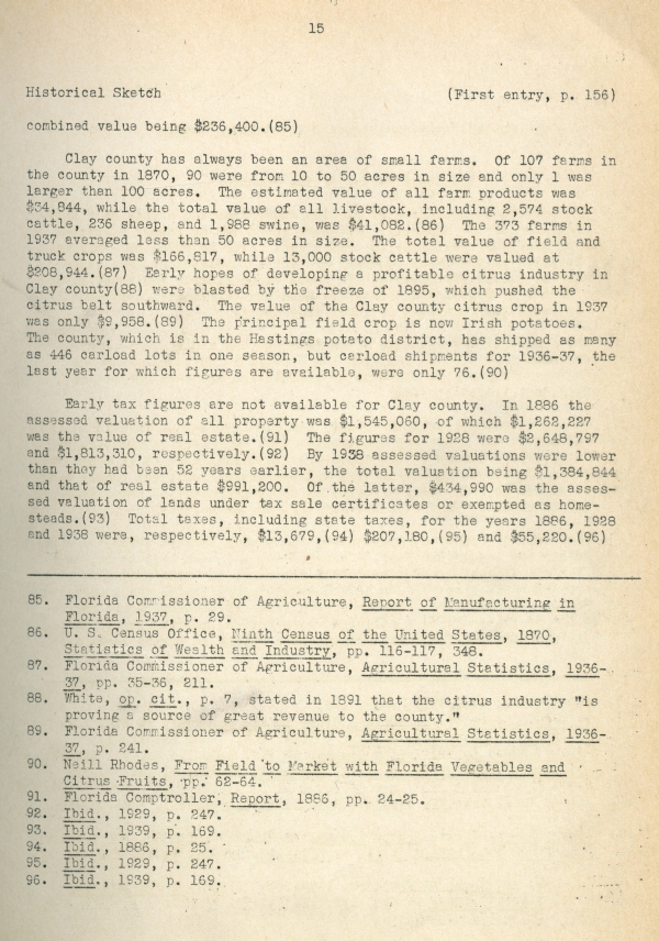
combined value being $236,400.(85)
Clay county has always been an area of small farms. Of 107 farms in the county in 1870, 90 were from 10 to 50 acres in size and only 1 was larger than 100 acres. The estimated value of all farm products was $34,844, while the total value of all livestock, including 2,574 stock cattle, 236 sheep, and 1,988 swine, was $41,082.(86) The 373 farms in 1937 averaged less than 50 acres in size. The total value of field and truck crops was $166,817, while 13,000 stock cattle were valued at $208,944.(87) Early hopes of developing a profitable citrus industry in Clay county(88) were blasted by the freeze of 1895, which pushed the citrus belt southward. The value of the Clay county citrus crop in 1937 was only $9,958.(89) The principal field crop is now Irish potatoes. The county, which is in the Hastings potato district, has shipped as many as 446 carload lots in one season, but carload shipments for 1936-37, the last year for which figures are available, were only 76.(90)
Early tax figures are not available for Clay county. In 1886 the assessed valuation of all property was $1,545,060, of which $1,262,227 was the value of real estate.(91) The figures for 1928 were $2,648,797 and $1,813,310, respectively.(92) By 1938 assessed valuations were lower than they had been 52 years earlier, the total valuation being $1,384,844 and that of real estate $991,200. Of the latter, $434,990 was the assessed valuation of lands under tax sale certificates or exempted as homesteads.(93) Total taxes, including state taxes, for the years 1886, 1928 and 1938 were, respectively, $13,679,(94) $207,180,(95) and $55,220.(96) _____________________________________________________________ 85. Florida Commissioner of Agriculture, Report of Manufacturing in Florida, 1937, p. 29.
86. U. S. Census Office, Ninth Census of the United States, 1870, Statistics of Wealth and Industry, pp. 116-117, 348.
87. Florida Commissioner of Agriculture, Agricultural Statistics, 1936-37, pp. 35-36, 211.
88. White, op. cit., p. 7, stated in 1891 that the citrus industry “is proving a source of great revenue to the county.”
89. Florida Commissioner of Agriculture, Agricultural Statistics, 1936-37, p. 241.
90. Neill Rhodes, From Field to Market with Florida Vegetables and Citrus Fruits, pp. 62-64
91. Florida Comptroller, Report, 1886, pp. 24-25.
92. Ibid., 1929, p. 247.
93. Ibid., 1939, p. 169.
94. Ibid., 1886, p. 25.
95. Ibid., 1929, p. 247.
96. Ibid., 1939, p. 169.
Chicago Manual of Style
Works Progress Administration, Historical Records Survey. Historical Sketch of Clay County. January 1941. State Archives of Florida, Florida Memory. <https://www.floridamemory.com/items/show/321087>, accessed 1 December 2024.
MLA
Works Progress Administration, Historical Records Survey. Historical Sketch of Clay County. January 1941. State Archives of Florida, Florida Memory. Accessed 1 Dec. 2024.<https://www.floridamemory.com/items/show/321087>
AP Style Photo Citation
(State Archives of Florida/Works Progress Administration)

 Listen: The Latin Program